


All Rights Reserved.- www.khairpurmirs.50webs.com 2011-2012 Webmaster Faisal Samo
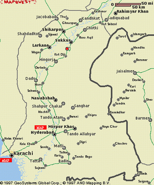
Khairpur's Location
Khairpur District is located in northern Sindh and is bounded on the north by Shikarpur and Sukkur, on the east by India. On the south by Sanghar and Nawabshah and on the west by Larkana and drives its name from the town
Demographics
According to the 1998 census of Pakistan, the district had a population of 1,546,587 of which 23.23% was urban. [1]. The average annual growth rate of the population is 2.71%. As per definition of Board of Revenue Sindh, Place of human habitation having at least ten houses are called settlement. There are 1,709 rural settlements in the district having population of 200 to 1000+ souls.
Following are the demographic indicators of the district as per the 1998 census of Pakistan:
Religion:
Islam: 96.86%
Hinduism: 2.93%
Christianity: 0.09%
Ahmaddiya: 0.07%
Others: 0.04%
Hindus and Christians are mainly concentrated in the urban areas
Languages:
Sindhi: 93.85%
Punjabi: 3.16%
Urdu:1.37% (mainly concentrated in the urban areas)
Baluchi:0.70%
Seraiki:0.34%
Pashto:0.25%
Others: 0.33%
[edit] Administration
The district has eight Talukas (counties):[2]
- Khairpur
- Nara
- Kot Diji
- Sobho Dero
- Mirwah
- Kingri
- Faiz Ganj
- Gambat
Khairpur Mirs